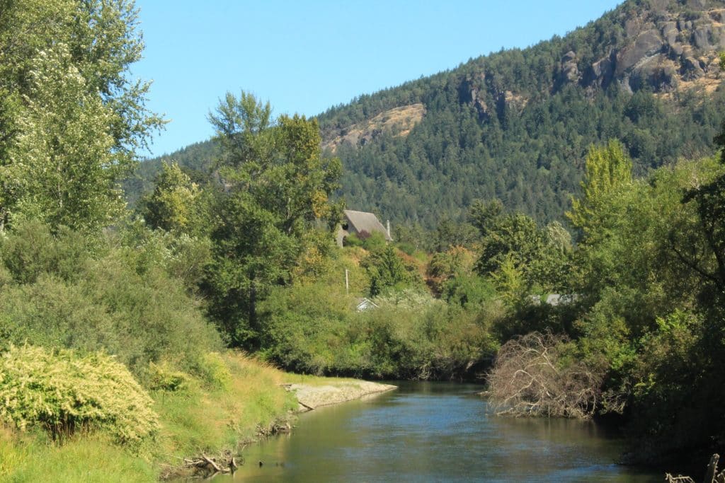
Sheltered away from the rough ocean waters on Quw’utsun lands is the Cowichan estuary, where fresh water from inland rivers meets the saltwater and a rare ecosystem forms. Only 2.3 per cent of B.C.’s coastline comprises estuaries like this one, yet 80 per cent of coastal fish and wildlife are supported by them.
Trails along raised dikes — formed by settlers to protect agricultural operations — are often visited by birdwatchers carrying long telephoto lenses to capture the wildlife interacting in the mudflats and marshy habitat of the estuary. Herons, hawks and other birds soar above, looking for their next meal. When the tide is low, an abundance of shellfish make an appearance in the sand. The estuary also serves as a nursery for young salmon as the fish acclimate to saltwater. When salmon return to spawn, they start their journey upriver from the estuary again.
The Cowichan estuary is one of the most ecologically significant areas along the province’s coastline, with up to 230 bird species utilizing the estuary as breeding grounds. It is also culturally significant to the Quw’utsun People, who have been living in relationship and stewarding the lands and waters of the estuary for millennia.

But rising sea levels — a product of human-caused climate change — pose a significant threat to the estuary. As does human activity, which has been disrupting the Cowichan estuary for generations.
That’s why a new initiative seeks to restore the Cowichan estuary’s ecosystem health and resilience. The Cowichan Estuary Restoration Project — led in collaboration by The Nature Trust of B.C., Cowichan Tribes, Ducks Unlimited Canada, the Ministry of Water, Land and Resource Stewardship; the Ministry of Forests; Fisheries and Oceans Canada, Environment and Climate Change Canada and the Habitat Conservation Trust Foundation — is the largest estuary restoration project to take place on Vancouver Island. It will restore 70 hectares of habitat and marshland along the Cowichan River estuary, giving it a fighting chance in the face of sea-level rise, and helping to ensure the vital habitat continues to provide for fish, wildlife and people into the future.
‘[This project] presents a really unique opportunity to not only restore to an estuary marsh but also to build in some resilience,” said Steven Henstra, a restoration biologist for the West Coast Conservation Land Management Program, with The Nature Trust of B.C.
Changes to the Cowichan estuary
“The Quw’utsun Mustimuhw (Cowichan People) have long been stewards of the lands and waters,” said Smaalthun (Larry George), Cowichan Tribes’ director of Lulumexun Lands and Self-Governance, in a statement. “We have witnessed the changes in our estuary over time, which have had a dramatic impact on our resources.”
Coast Salish food sovereignty advocate and cultural educator Jared Qwustenuxun Williams previously reported for The Discourse on the significance of watersheds and the many issues watersheds on Quw’utsun lands are facing. He wrote of the estuary, where the Quw’utsun and Xwulqw’selu rivers come together to meet the ocean.
“I’ve been told glossy-eyed stories of the crabs in the Quw’utsun estuary. There were so many they could be raked in the dozens without harming the population,” Qwustenuxun wrote.
Elders shared stories recalling clam digging in Cowichan Bay and a sandbar filled with shellfish that would be harvested at night, with lanterns lighting up the beach.
“But, for my generation, it appears that the crab bounty is all but gone or much smaller and more infrequent,” he wrote. “What sparse shellfish are on the sand and silt are all contaminated and inedible. A place of endless bounty has become a reminder of times past for those who know the stories.”
The Cowichan estuary is at risk of drowning
The Cowichan estuary has been undergoing significant changes since the 1800s, including river training, diking of marsh habitat for agricultural purposes and use of the estuary for logging and shipping. The estuary was bisected in the 1950s by the construction of the Westcan Terminal Causeway, cutting off the southern half of the estuary from the Quw’utsun Sta’lo’ (Cowichan River) and altering tidal processes.
Since 2018, the partners of the estuary restoration project have been studying and assessing the estuary’s resiliency to climate change impacts. They learned that the projected rate of sea level rise is about three to four times the rate of sediment being created on the marsh surface, Henstra said. This sediment is necessary for marshy plants in the estuary and other wildlife to thrive.
Based on this five-year study, approximately 50 per cent of the marsh area in the estuary will be lost by 2050, and more than 90 per cent of it will be drowned out by 2100 if no interventions to support the estuary occur, Henstra said.
“So it’s quite a significant and severe impact, and that’s assuming that there’s no significant change in emissions levels.”
Combatting ‘coastal squeeze’
Since 1985, the Nature Trust of BC, Ducks Unlimited Canada and other partners in the Pacific Estuary Conservation Program have sought to protect the estuary through land purchases, donations and covenants. The areas that the new restoration project will focus on — the Koksilah Marsh and Dinsdale Farm — were acquired between 1985 and 1990, according to a news release.
Henstra said dikes in the Koksilah Marsh and Dinsdale Farm areas were installed to support pasture land for cattle and agriculture. The dikes present a “hardened shoreline that greatly reduces the ability of the marsh to provide its basic ecosystem functions, like water and sediment filtration and flood attenuation.” The dikes also prevent the land behind it from interacting with the tides.

Typically in an estuary, the land is periodically inundated by the tide and by freshwater flows from upstream. The intermingling of water creates a unique environment for very specific vegetation and wildlife to thrive. Some areas are more frequently inundated by the tide, while others are only impacted by high tide. This creates two different types of habitat — low marsh and a higher estuary meadow, which has more biological diversity.
As sea levels rise, the low marsh will be drowned out and become mudflats and the high marsh will transition into low marsh, Henstra said. With sea water encroaching on one side and dikes preventing any movement further inland, those habitats are impacted by something called “coastal squeeze.” They have nowhere to go, and could eventually disappear.
“There’s an opportunity to remove the dikes and restore the land behind the dikes to a natural marshland ecosystem,” Henstra said. The restoration work will also make space for the habitat with rising sea levels, building in resilience for the future.
Over the next two years, the Cowichan Estuary Restoration Project will remove over two kilometres of dikes at Dinsdale Farm and Koksilah Marsh. Intertidal channels and salt marsh habitat will be created and marine riparian habitats will be restored. Areas that were historically cut off from the tide will also be reconnected.
Visitors will still be able to access the estuary from Westcan Terminal Road while project work takes place. The Dinsdale Farm dike trail will no longer be accessible, as the project will remove the dike that the trail is on. Learn more by visiting the project website.
What did you think of this story?
Your feedback after we publish a story helps ensure we're always improving our reporting to better serve you