Jared Qwustenuxun Williams is a Coast Salish food sovereignty advocate, a cultural educator and a contributing writer for The Discourse. There is a glossary of Hul’qumi’num words at the bottom of this article.
There exists a mighty river that carved its way down from high mountain tops and wove its way through old growth forests. Rainfall, snow pack, and underground springs feed the multitude of creeks that flow into the river. Water is carried from its source, at the mountain lake above, to the many thirsty plants and animals below.
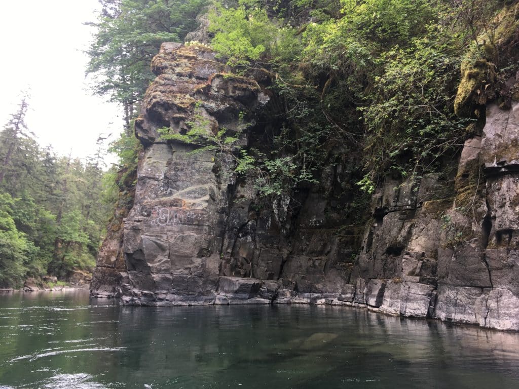
This ancient Quw’utsun Sta’lo’ cascaded over dozens of waterfalls and encountered more than a hundred sets of rapids on its way to the sea. The thick forest in the mountains above kept the river’s flow clear and consistent year round. A deep lake at the source of the river kept it cold and flowing even during times of drought. The lower river forked as it entered its estuary, creating a massive silty beach that ran on for kilometers.
The Sta’lo’ was the lifeblood of the ecosystem. It not only shared its life, giving bounty with the surrounding forests and creatures, but it also shared its depths with a plethora of finned and insect relations. Entire species called the river their home, some living in the river permanently while others visited at different times during their lives.
For untold generations, stseelhtun have spent their youth cradled in the river’s flow before leaving to the sea, only to return in their adulthood to create the next generation of stseelhtun. Each successive generation, for millenia, have left their home and returned always certain the river would be waiting for them when they were ready to return.
Related story: It’s all connected: A Quw’utsun watershed story
The first person
When the time was right, the first person came to the river and declared it to be a sacred place. As the story goes, this first person’s name was Syalutsa and he dedicated his life to bathing in every creek and tributary of the great river. This first person was soon joined by other people in the valley and they formed the first villages along the river.
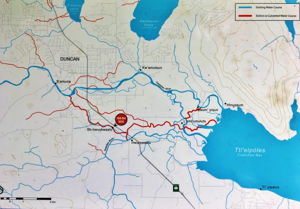
The river showed the people where to build their first village, for the strong ocean tides could push water back up the river from the sea, up to a certain point. It was where this rising tide stopped that the people would build their village. This allowed the people of the village to paddle their snuhwulh up the river to the village with ease on a rising tide. There were also two great creeks where the first village was built that flowed into the river from the lakes above. In time, the village would grow so vast that it would run all the way up these creeks to their sources at the lakes. Like natural highways, the creeks and rivers connected the people to the sea and its incredible bounty.
Eventually, the Smeent Mustimuhw moved down from their village in the upper watershed to the lake, and other villages grew and formed down river. Although these new villages were made up of different families, the people shared a common understanding: The river was sacred and its bounty was common and the people would not harvest more than they needed.
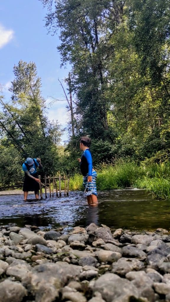
The people developed vast technologies and economies based on the river and its cycle. The fishing weir technology was developed to allow the people to fish selectively and breed stronger and more resilient salmon returns. Generation after generation of the people would selectively fish and leave the strongest males and females to spawn, ensuring that each successive generation was more prolific than the last. In time, the salmon returns on the great river became renowned throughout the world.
Beyond the sta’lo’
Life on the river had shown the people how to make great and strong snuhwulh that eventually took them to the sea. The Sta’lo’ Mustimihw created a vast network of villages in the many bays and coves they found on the surrounding islands. Most of the island villages were fishing or gathering sites that would be populated more densely during the busy seasons and sparsely in the winter. Some of these island villages were specialized shellfish farms where monolithic stone walls were built to create and enhance natural shellfish habitat. These qwext tu saxwu’ became an integral food producing powerhouse that fed the nation and beyond.
The Sta’lo’ Mustimuhw mastered the art of smoking and drying food for long term storage. This ability gave the people an advantage, not only in stockpiling food, but also utilizing its shelf life for trade purposes. Soon, the Sta’lo’ Mustiimuhw grew and expanded their family’s reach across the sea to the great rivers beyond. The people created a vast trade network that connected them with other Sta’lo’ Mustiimuhw and Kw’atl’kwa Mustimuhw all along the continent. Great cedar boxes filled with dried clams and other shellfish would be traded for obsidian or jade from hundreds of kilometers away. The Sta’lo’ Mustimuhw were at the center of a great coastal civilization.
Back at their home village, the Sta’lo’ Mustimuhw had grown into one of the largest villages in the territory. With this great population and economic power, many of the surrounding villages and families held the Sta’lo’ Mustimuhw in great esteem. Their power made them generous and peaceful, with some even calling them the philosophers of the coast.

This civilization of interwoven economies, languages and cultures was created around a river; a river that drew the power from the mountains and enchanted even the first ancestor of the river people; a river that would provide endless water, food and life for untold generations; a river that cradled the ancient civilization of my ancestors.
This is a story of the mighty Quw’utsun Sta’lo’ which was once the center of a massive Indigenous nation. A river that once fed and moved an entire civilization. A river that many people simply drive over and pass by. A river with a history that goes back before even our first ancestor, Syalutsu, arrived in Quw’utsun.
Hul’q’umi’num Glossary
Quw’utsun – Cowichan
Syalutsu – Name of the first ancestor
Sta’lo’ Mustimuhw – River People
Sta’lo’ – River
Kw’atl’kwa Mustimuhw – Ocean People
Qwext tu Saxwu’ – Clam Garden
Snuhwulh – Canoe
Stseelhtun – Salmon
Smeent Mustimuhw – Mountain People
What did you think of this story?
Your feedback after we publish a story helps ensure we're always improving our reporting to better serve you