What’s the First Nations history of the Duncan area?
Imagine a row of longhouses stretching from the Somenos Marsh to the Cowichan River.

What’s the First Nations history of the Cowichan Valley? That’s a question we at The Discourse Cowichan have heard quite a bit in recent weeks, in response to our survey on the communities we call home.
“I wonder about the history of the First Nations people right here, under Mt. Prevost specifically,” Karen, a resident of the Berkey’s Corner area, near Duncan, shared with us.
Last week, we touched on the pre-colonial history of the Berkey’s Corner area. This week, in response to Karen’s curiosity and that of others who have reached out, we’re digging a bit deeper. And we enlisted some expert help.
Home is where the longhouse is
“The Elders say that wherever you see the mountains, right around, that’s where our Cowichan Tribes villages were,” Qwiahwultuhw (Robert George), an elder with Cowichan Tribes, shared with me over tea last week. “As far as the mountaintops, that’s where our village was.”
Longhouses were built close to rivers or the ocean. That’s where most of the food gathering happened, Qwiahwultuhw said.
“We had longhouses all around the whole valley here. Each family had their own longhouse they lived in. All the grandparents, parents, aunts and uncles, children, grandchildren, all lived together in the longhouses.”
Qwiahwultuhw traces his family to the village of Lhumlumluts’, at Cowichan Bay. The name of that place describes the way the shore bank is carved out by the tides, he said.
Those were winter homes, Qwiahwultuhw said. “We always kept the fire going in the longhouse. That was our warmth, our hydro.”
In the summer, Quw’utsun (Cowichan) families paddled by canoe to fishing camps on the Fraser River, where they’d stay for three or four months, Qwiahwultuhw said. (The Cowichan Nation Alliance, including Cowichan Tribes and neighbouring First Nations, are suing the government of Canada and others to reclaim rights to that land.) They would return with boats full of smoked and dried fish, and traded goods from as far away as California.

Jared Qwustenuxun Williams prepares Pi’qwun, a traditional salmon preparation, at Quw’utsun (Cowichan) River Day on Sept. 28, 2019. Photo: Barry Hetschko
Below Swuq’us
The area below Swuq’us (Mount Prevost) was once home to the village of S’aumna (Somenos), Jared Qwustenuxun Williams, a member of Cowichan Tribes, tells me by Facebook message. That village spanned from what’s now the BC Forest Discovery Centre to the Allenby Road bridge, a span of several kilometres, he said. “It was one of our larger villages with houses and buildings running all the way along.”
The marshlands by S’aumna Xatsa’ (Somenos Lake) were full of medicinal plants, Williams said. “Wetlands produce many rare medicines that are less and less common as wetlands are less and less common.”
Bings Creek was like a highway from the village to the hunting grounds up Swuq’us, he said. “The big flowing creek of the past was big enough to hold salmon and canoes. People could travel up the creek into the base of the mountain. And when they got up there they could take a detour and go up Menzies Creek up into the Hill 60 and Chemainus River area. So, imagine once again, that these creeks were highways from cultural and hunting areas to the village of S’aumna. The base of these creeks, and the whole way up for that matter, would be populated with homes, people, and artifacts.”
Cowichan Tribes lists seven primary traditional winter villages, of which S’aumna is just one. Kwa’mutsun (Quamichan) was the largest. The population of all Quw’utsun villages together may have been around 15,000 before European settlers arrived, bringing with them foreign disease that wiped out an estimated 90 percent of the Quw’utsun people.
Want to learn more?
Those Who Fell From The Sky, a book published in 1999 by Cowichan Tribes, documents the history of Quw’utsun peoples through their eyes. It includes origin stories, information about landmarks and the history and legacy of colonization. Copies can be borrowed from our local public libraries or purchased in person at Cowichan Tribes’ Culture and Education department, 5744 Allenby Road. [end]
What did you think of this story?
Your feedback after we publish a story helps ensure we're always improving our reporting to better serve you
Author

Related Articles
Cowichan SPCA calls for more foster volunteers as demand for space increases
As demand grows for animal shelter space, a team of volunteers and Cowichan SPCA staff are working to make sure animals find a place to call home.

Immigration partnership program aims to make the Cowichan Valley more welcoming to newcomers
A new federally funded partnership wants to understand what barriers immigrants face when they arrive in the Cowichan Valley.
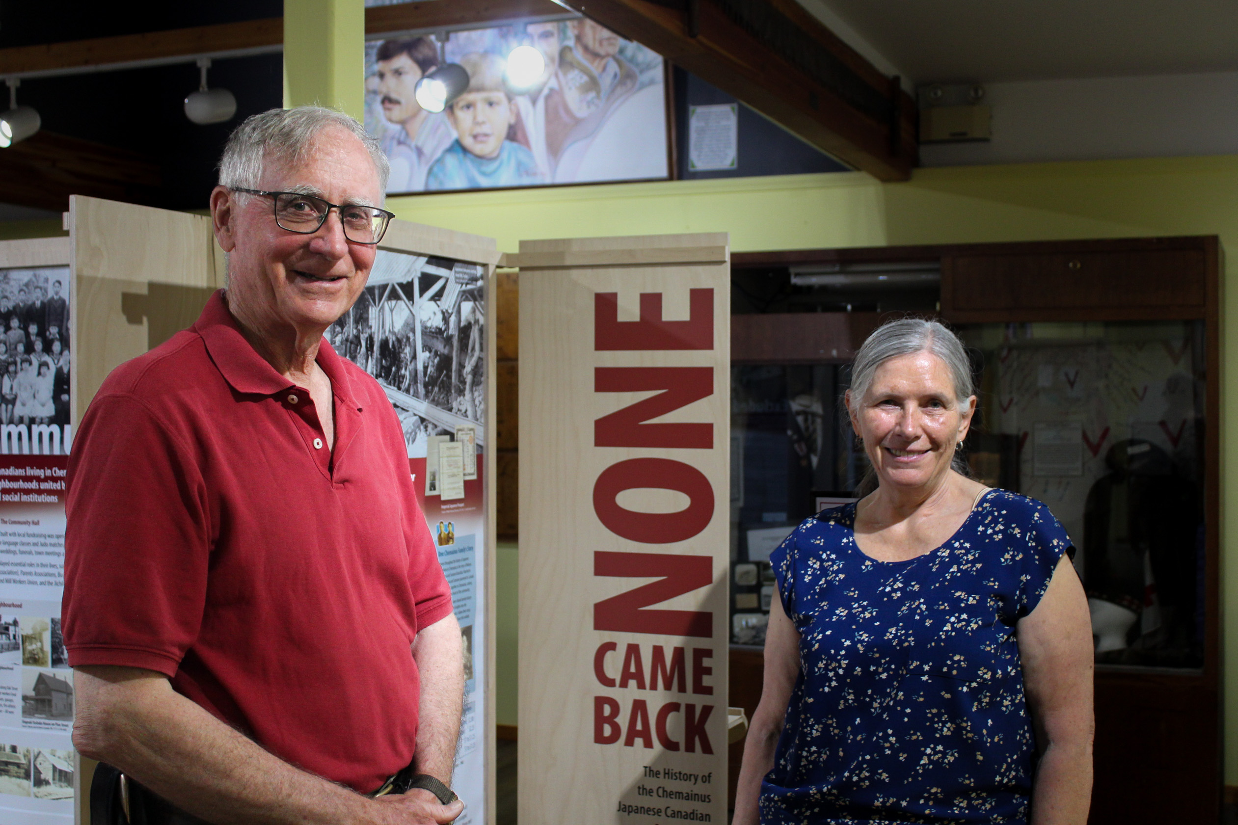
None Came Back: Documenting the untold stories of the Japanese community in Chemainus
New exhibit at Chemainus Valley Museum aims to highlight and give voice to the Japanese Canadian community that once lived in Chemainus.