A study of the Xwulqw’selu (Koksilah) and Chemainus watersheds has surfaced new information about their poor state of health — and opportunities for restoration.
The Twinned Watersheds Project, co-lead by Cowichan Watershed Board, Cowichan Tribes and Halalt First Nation was launched in 2021 to document the state of the watersheds and identify possibilities for improving their ecological health. Salmon are specifically being studied as part of this five-year project because they are a keystone species that helps signal the health of a watershed.
“It’s a bit of a tipping point that has been reached, and we’ve fallen off that tipping point,” says Cheri Ayers, a local fish biologist who is the project’s fish habitat and flows assessment manager.
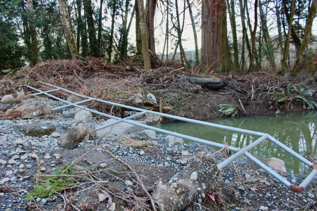
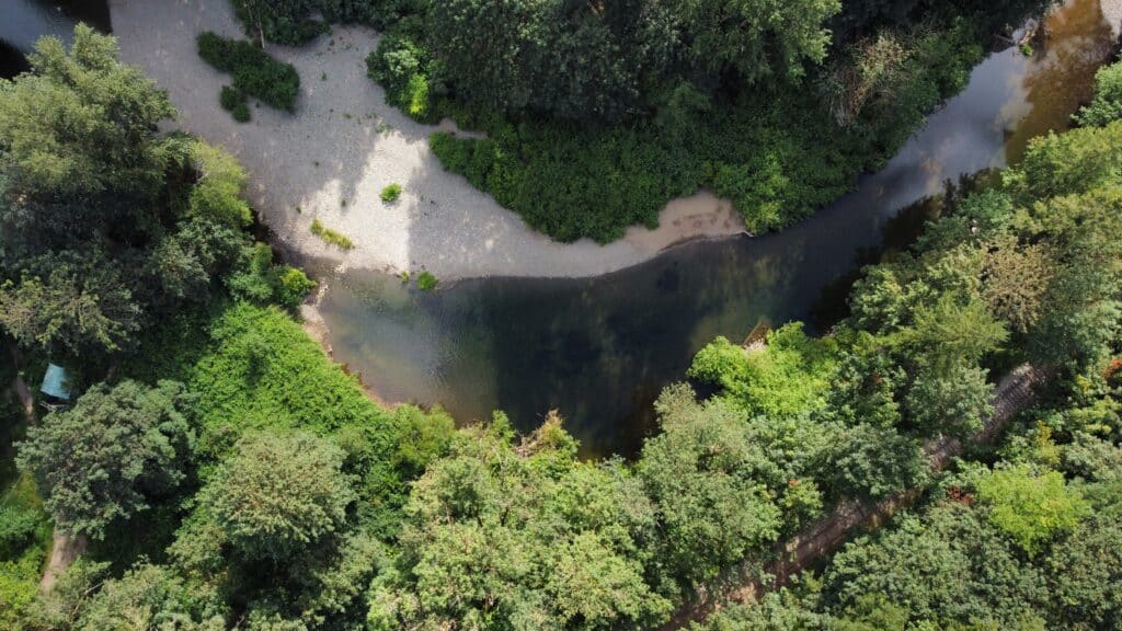
The Xwulqw’selu and Chemainus watersheds are both located in the highly privatized, highly degraded landscape of southeast Vancouver Island, and they face similar issues. The rivers and their tributaries have been deeply impacted by land use and climate change. Unlike the neighbouring Quw’utsun (Cowichan) watershed, the Xwulqw’selu and Chemainus rivers have no lake to store water, which leaves them more vulnerable to drought and dangerously low flows.
Fish habitats are suffering, and so is the land and wildlife surrounding the rivers. The rainy season brings strong, rushing water through the watersheds, impacting vegetation and fish habitats. The influx of water also forces rivers into straight, rectangular bathtub-like shapes, much different from the meandering rivers they used to be. Meanwhile, dry spells in the summer mean there isn’t enough water — particularly cool water — for fish to survive, and the vegetation suffers, too. With climate change, rainfall has become harder and faster while droughts have become more severe and longer lasting.
High and low water flows impact the people who rely on these watersheds as well — particularly the Indigenous people who have lived alongside and in relationship with the watersheds for millennia.
While the watersheds are in critical health, the Twinned Watersheds Project has also surfaced solutions to bring them back to a place of abundance. Restoration projects could help to slow down the rivers and allow them to meander.
“Now we have to kind of figure out how to crawl back over that hump to get back into that place where the [rivers] can move more and can be adjustable in [their] profile,” Ayers says.
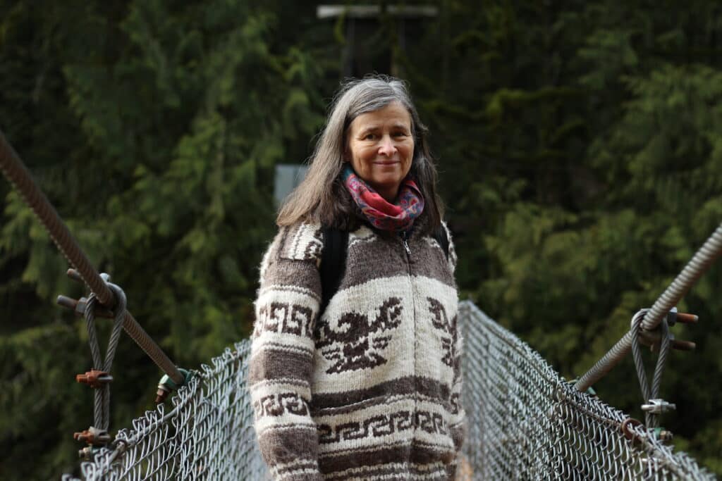
Big, landscape-level changes are needed, too, says professional forester Heather Pritchard, who is the project’s riparian habitat lead.
“If we want to make real change, real differences, we have to completely rewrite the model on how we manage our ecosystems,” Pritchard says. “We need to start harvesting [fewer trees] and we need to start putting a bunch of these roads to bed — restoring them, reclaiming them and getting the natural hydrologic functions back into a more normal version.”
Read also: It’s all connected: A Quw’utsun watershed story
‘A loss of watershed integrity’
A report about the flow and health of the Xwulqw’selu (Koksilah) River says there are major water supply deficits in the watershed when considering what salmon need in the summertime to survive.
The report says a “loss of watershed integrity has destabilised key ecological functions in the Koksilah watershed.” These water supply deficits impact people and nature for a minimum of four months of the year.
Water levels in both rivers are “massively below” what is considered suitable for a healthy salmon habitat, Ayers says. She recalls being able to step across the Chemainus River in 2021 — a river that is twice as wide as the Xwulqw’selu.
“I think we are at a critical state, so any withdrawal out of the river has the potential to significantly impact it,” Ayers says. “We don’t have any room to move. We’re right at the very, very bottom where the river is going to go dry.”
To better understand the relationship between salmon habitat and the aquatic ecosystem, researchers put together a habitat atlas. The atlas maps out features of the two rivers, including pools, riffles and glides, among others. Pools that are at least a metre deep serve as cold water refuges for fish. Riffles typically occur when there’s an elevation change, where the water is rough and frothy, causing it to hold more oxygen. Riffles are productive for fish, Ayers says, as bugs knocked off the riffle float downstream and become food for fish in the pools. Glides serve as transition habitats for fish between pools and riffles and are the least productive of the three.

On both rivers, Ayers says researchers identified really long, deep glides and very few pools and riffles. Extreme high water flows with powerful discharge in the rivers, as well as extreme low flows and low water discharge, have shaped the rivers and the land around them, creating more glides and disturbing areas where pools and riffles once were.
“We have a serious condition here in terms of salmon habitat and really, aquatic ecosystem functions,” Ayers says.
The importance of riparian ecosystems
Riparian ecosystems are made up of the transitional areas between water and land. They have characteristics of both aquatic and terrestrial ecosystems, such as fallen trees that are both on the land and in the water or fish carcasses that have been deposited on land. They also include animals that are both on the land and in the water, such as beavers or otters.
“Riparian ecosystems are considered the most important ecosystem of all the different types out there,” says Pritchard. “It just contains a very special structure and functionality that benefits not only water quality and fish habitat, but it tends to be an extremely important habitat for wildlife.”
On a Tuesday in January, Pritchard walked through Bright Angel Park along the Xwulqw’selu River and pointed out root systems that are helping to hold soil in place, and areas where rushing energy from the river has eroded the banks over the years.
“This really demonstrates some of the important reasons for having riparian habitats: the vegetation’s ability to slow down water, take the energy out of water, so we have less erosion,” Pritchard said.
Large trees are crucial to rivers because of their ability to shade the water and keep it cool. Their root systems provide cover for small fry, and when the large trees eventually fall, they provide places for fish to hide. Large trees also help to slow down the flow of water down slopes and into the river, reducing flooding. And, as fallen trees decompose, they act as sponges, holding 25 times more water than the soil they are resting on, Pritchard says. This water becomes crucial during summer droughts because it helps to support and feed the vegetation around the trees.
Riparian health in the Xwulqw’selu and Chemainus watersheds
Pritchard says she likes to approach her work with a lens of hope and was pleased to see that the riparian ecosystems within 100 metres on either side of the lower reaches of the Xwulqw’selu and Chemainus rivers were in “relatively good shape.”
“They weren’t recovered, but they were recovering,” Pritchard says. “What was lacking was large structures.”
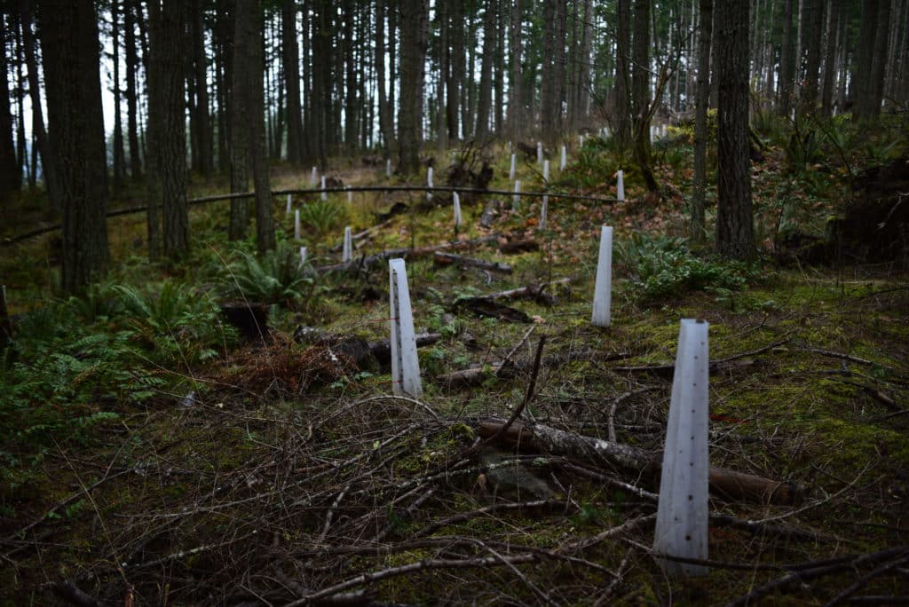
Most of the riparian ecosystems along the rivers are filled with much smaller trees and younger forest due to historic and ongoing forestry practices. In the Xwulqw’selu watershed, one per cent of original forest remains and new trees will take hundreds of years to function the same way old, large trees did.
“When you have a younger forest, you have less structure, less dead trees, less fallen trees. And those are the pieces missing,” Pritchard says.
As water rushes down the mountain slopes and into the watersheds, erosion occurs and the shape of the river channel becomes straight and wide, Pritchard says. That’s the opposite of what fish need. Erosion also adds more sediment to the river, which impacts fish eggs.
Both rivers are considered to be flashy, with flows that rise and fall rapidly with the weather, Pritchard says. The straight, wide channels and the absence of a lake for water storage contribute to this dynamic.
“When you have a flashy system like this, it becomes really important to have our riparian forests, and even more important to have our forests in upslope areas,” Pritchard says.
Roads and railroads in the broader watershed also become conduits of water, Pritchard says. They collect water, deposit it into ditches and the water — unchallenged by vegetation — flows directly into the river system.
According to Pritchard, Riparian ecosystems that were in the best condition along both rivers were on First Nations reserve lands and in rural residential areas where there are still high amounts of forest cover. Areas where riparian forest were most disturbed were in agricultural zones.
Read also: Reporter’s Notebook: Learnings from the Xwulqw’selu Sta’lo’
Protecting riparian areas
A Twinned Watershed Project report assessing riparian vegetation in both watersheds says legislation can help protect riparian areas.
Within the roughly 13 kilometres of the Xwulqw’selu and Chemainus rivers that were assessed, there are three different provincial acts, one federal act and several local government bylaws that regulate riparian area protection based on land ownership and use. Each piece of legislation dictates different sizes of riparian buffer zones where no harvesting or road building can take place.
The largest protected buffer zones exist on Crown land, whereas private managed forest and residential, commercial or industrial lands see smaller riparian protection areas. But as stream widths get smaller, so do buffer requirements. That means tributaries end up with minimal tree cover, the report says.
“Without adequate riparian protection, rain storms or fast moving water enter important fish streams with large amounts of sediment, causing harm to fish habitat,” the report says.
When it comes to streams on agricultural land, there is no provincial legislation that requires riparian buffer zones except where new residences are planned. And the federal Fisheries Act applies to fish-bearing streams in all land-use zones, but does not have any firm requirements for riparian protection areas, the report says.
It’s not all bad news. Pritchard notes that North Cowichan has taken positive steps to identify and protect riparian areas along the Chemainus River that fall within its municipal forest lands. A few years ago, the municipality compiled a sensitive ecosystem inventory, and it laid out riparian protection zones that “make sense,” Pritchard says.
Riparian protection zones should be determined by natural features and boundaries, and not by standardized setbacks, she says. That’s what was done in the municipal forest lands.
“They ended up with a very wide riparian protection zone along the Chemainus River,” Pritchard says. “Then you go just further upstream out of the municipal forest, and into the Crown and privately managed forest areas, and you can see where they pulled out their measuring tapes. So you go from this large riparian protection zone to something very small.”
Interventions, both big and small, are needed
Environmental restoration work in both watersheds could help slow the water down, reducing flooding and erosion, Ayers says. It could also give the water more opportunities to interact with the landscape as it moves through the whole watershed. Field work that took place as part of the Twinned Watersheds Project helped identify immediate restoration opportunities — particularly along streams and tributaries — to help increase water levels in and improve fish habitats.
Ayers says these restoration opportunities are low tech, such as building beaver-dam-like structures.
“We need to look for areas where we have the ability to slow the water down, store more water and make the river — or whatever little creek we’re working on — move a little bit more and interact with its floodplain more,” Ayers says.
During critical periods of drought, reducing water use helps as well, Ayers says. She notes that irrigation restrictions for farmers along the Xwulqw’selu River, ordered during summer droughts in 2019 and 2021, helped the river “bounce back fairly significantly.”
Making deliberate choices to not build or develop in the floodplain — in order to give the rivers room to move and meander as they once did — can also help improve watershed health, Ayers says. Roads, railroad tracks and urban development tend to force the rivers into one straight channel, and pulling back on that development can give the rivers more space to interact with the land. This can slow water flow and improve water storage in the riparian areas.
Pritchard says any planting and restoration work that private landowners can do in riparian areas helps, too. Making a conscious effort to not cut down trees and to leave deadfall in riparian areas benefits the health of the watersheds, she says.
The watersheds are in dire need of support, Pritchard says, and big changes need to take place — from the areas along the rivers to the upper reaches of the watersheds. That means restoring riparian areas, and it also means allowing forests to grow older and reclaiming some of the logging roads that snake through the watersheds. Getting there will take an overhaul of ecosystem management and land use practices, Pritchard says.
The Twinned Watershed Project is gathering the information needed to point the way forward, but it will take further action from governments and decision-makers to fund the restoration work and make the needed regulatory changes.
On that front, there’s hope, too. Cowichan Tribes and the Province of British Columbia recently agreed to collaborate on a Xwulqw’selu (Koksilah) Water Sustainability Plan, a first-of-its kind initiative to re-write the rules for land and water management in the Xwulqw’selu watershed. The plan aims to take a holistic approach to watershed health and could set a historic precedent for watersheds across the province.
Sign up for the Cowichan newsletter to be the first to read our upcoming report on the Xwulqw’selu (Koksilah) Water Sustainability Plan.
What did you think of this story?
Your feedback after we publish a story helps ensure we're always improving our reporting to better serve you