After years of extreme droughts, what’s in store for Vancouver Island’s watersheds?
Vancouver Island University’s Alan Gilchrist is researching how water flows may be affected by climate change.
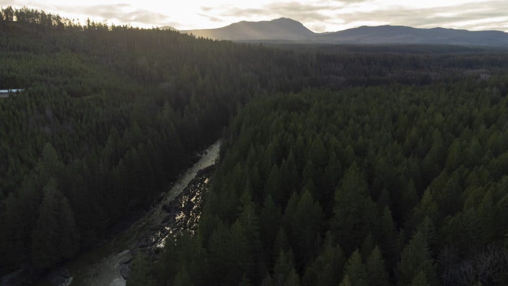
When it comes to water management amidst a climate crisis, even resilient systems may experience challenges, says Vancouver Island University geography professor Alan Gilchrist, who’s in the midst of a six-month research project to study how water moves through the mountains, lakes and rivers on Vancouver Island and how humans use that water.
I sat down with Gilchrist to learn about how several years of long droughts could impact our water levels, how he’s advocating for water-centric policies when it comes to building new developments, and how groundwater aquifers could be at risk if we don’t really know precisely how much water is there and how much people are using.
We also discussed the future of snow on Vancouver Island (hint: the outlook is not great) and whether a warming planet translates to long-term trouble for tree species like cedars.
Read the interview, which has been condensed and edited for clarity.
Julie Chadwick: How is your current research delving into the ways humans use water and how we can better manage it?
Alan Gilchrist: In 2018 and 2019 I developed a model that looked at 12 watersheds around Vancouver Island that does a pretty good job of describing exactly how water moves through the environment — water coming in as precipitation, how it builds as snowpack in the mountains, it fills lakes and moves down through our rivers.
And the systems are very different. Some of them are dominated by watersheds where it rains a lot, like down Island.
Other watersheds are more in the central, higher elevation parts of the Island in Strathcona, where there’s a lot of snow. So that really dramatically changes how water is both temporarily stored seasonally, but also how it just moves down through the watershed.
Part of that project looked at climate change and how the flows may change because of global warming. This semester, I’m really invested in trying to marry that natural understanding of how the water flows with a greater understanding of exactly how humans use water.
The problem with that is that although in some aspects we have a very good handle on how humans use water, that is not the case for many people or many institutions on Vancouver Island. They’re not on metered water, they are maybe tapping into groundwater. It’s a little bit of a black box, and not super sophisticated.
So I’m trying to come up with a general model that will at least put some sort of prediction on that, and look at what is the amount of water that humans are using, how much water is actually available from a pre-existing model and where is the stress being developed in the system — because we know that certain watersheds are getting pretty stressed.
In trying to put together all those pieces, maybe we can be a little bit more proactive about water management and use a more water-centric approach to planning, rather than the kind of situation we see in a lot of jurisdictions around the world, where we tend to use water until we start having problems and then we start reacting.
JC: So ‘here’s how much we have and here’s how much we use.’ How do we chart out how those things come together?
AG: For example, we might have a watershed and say, there is this much water that is available for humans to use, and the rest of it is being used by the natural ecosystem. As humans, we’re supported by the ecosystem, so we can’t just take water from the trees and the animals and the insects for our use or the whole system collapses. Let’s try to figure that out upfront so we can more intelligently develop our communities.
JC: I spoke with Bill Sims at the City of Nanaimo about the water situation, but I am curious about the effects of cumulative drought on the natural environment.
AG: Let’s talk about the drought first, and then about some of the impacts. If you look online, the B.C. government’s been very proactive about publishing a lot of information on things like water levels and drought levels. They have a drought information portal which maps current drought levels in B.C., split by 34 water regions.
Starting around June, when normally we start to see the summer kick in and water levels in rivers or groundwater starts to drop, they rank these different areas according to a classification system where the base level is zero — basically no drought, and then have Levels 1 to 5.
We had a very unusual drought this year, because not only was it very long, but fairly serious drought conditions started in early June. Normally it’s much later than that.
It’s also covering a very large part of the province. There are 34 different regions and 21 of them — two thirds — were in drought Level 5, pretty much all of the lowermost part of the province, Vancouver Island and then bits of the north.
Drought Level 5 means adverse impacts are almost certain on the surrounding ecosystems. This system’s been in place for three years, and we’ve had drought Level 5 in each of the last three years. On Vancouver Island, it’s been every year.
A drought tends to conjure up this idea of something that happens once in a lifetime. It’s a major event, it happens, and then we don’t have to deal with it again. But when it happens every year, I think the reality is that maybe this is the way climate change is now being manifested in parts of B.C.
While this is a very long and unusual drought, it’s probably going to become a lot more frequent, and something we’re just going to have to manage, as part of business as usual.
You mentioned Bill Sims, and I think the good news from a water perspective, is that many of the water managers are very aware of what is potentially happening and the implications of climate change. Some of them have been very proactive or have been fortunate, as explained by Bill, that Nanaimo inherited a system back in the ’90s that is fairly robust and resilient to these droughts.
Ultimately, what we don’t know is, if these very long droughts become more frequent and that becomes the new normal, that may be not be as easy to manage as one that lasts a few weeks.
The other point that Bill made is the fact that some systems are naturally a little bit more resilient. As Nanaimo is using a surface water source and has a relatively large watershed, they can control the height of the dam and how much water they’re actually storing. In any given year, as they see the weather developing and the indications of an impending drought, there are certain things they can do to manage the water supply.
One of the things they really benefit from, for example, is that in many years there is quite a large supply of snow, so that as soon as the summer starts, that water starts to melt, and as they’re drawing from the reservoir it’s continuing to fill for a period of time before the summer really takes off.
Now, other systems — like in groundwater systems in areas where there’s already been a lot of changes to the landscape — there’s very little you can do to proactively manage a groundwater source. If the groundwater levels are naturally low, then there isn’t a way to boost the storage, apart from trying to make changes to the surface environment to enhance the retaining of water in the longer term. There’s a lot of moves now in land use planning to try to do that.
JC: How? Are these groundwater systems more susceptible to climate change’s cumulative effects?
AG: I think one of the biggest things is that we are less sure of the extent and the productive natures of these aquifers. By their very nature, they’re underground, so we can’t see them. The province has a program, because a lot of people are on domestic water wells, that when you drill a well for your property in a rural area as a water supply, that the information is given to the province so they can have some sort of idea what the underlying geology looks like.
And when you have a lot of information in there, you can start to map exactly the extent of these productive aquifers. That’s a great system. But historically, not all individuals have shared that information with the province.
The second thing is if you’re a single residential user, you don’t have to be licensed. Under the new Water Sustainability Act, non-domestic and larger users (250 cubic metres a day or more) do have to be licensed, they have to apply to the province and get a water allocation. But historically, it hasn’t been that well defined.
It’s different with a municipality. Because the City of Nanaimo has a dam in the south Nanaimo watershed, they’re effectively the only user. They maintain the dam, they draw down the water, they know exactly how much water there is, how much is going through their pipe system to the individual homes.
It’s just inherently a lot more well-constrained than a groundwater system, where we have an approximate idea of the size of this aquifer and how much water is down there. But we don’t really have a very good handle on how much water people are extracting, even though they may have a license to extract a certain amount, there isn’t the same reporting. It’s just inherently a system that isn’t well-defined.
JC: So we were heading towards what the cumulative effects are of droughts on the natural environment.
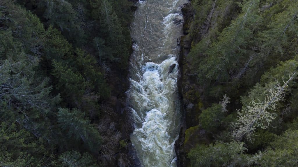
AG: Let’s talk about the ecosystems that are supported by a particular river system. The water that’s within a river normally comes from a couple of different sources. If you have a long period of drought, then you’re not getting water coming in as rainfall. For example, during the winter when it rains a lot around Vancouver Island, a lot of water just flows off across the landscape and it keeps the rivers nice and full.
In summer, you don’t have that, because the summers tend to be a lot drier. So what the natural ecosystem is relying on, because many of the rivers don’t get dry — they’re perennial rivers, they run year-round — is these groundwater aquifers. The aquifers are leaking a little bit of water into the river system and that allows the river to maintain its flow.
That’s what’s known as base flow — water that’s coming in from the underlying aquifer. We had no rain for a few months, but you could still go down to the Nanaimo River or the Millstone River and you’d see that river is still flowing, because it’s coming from the groundwater system.
But part of the problem is that there’s still all these people who are trying to use it as a source of water as well. Whether it’s a domestic user with a well that is drawing out water for daily uses, or farmers who are using groundwater for irrigation.
What can happen is, without a lot of rain, eventually the water levels will start to drop because at some point, unless you start putting more water into the whole system, then they will continue to drop. But because of human water use, that drop can be accelerated to the point where a river can go dry.
It doesn’t mean to say that the aquifer is exhausted, it just may be that the groundwater level has dropped below the level of the river valley so no water flows. This was the situation on the Koksilah River, south of Duncan. Their water levels got critical to the point where it was almost running dry back in August, so the province put in water restrictions. That is then used as a measure to lower the human water and allow the environmental flows to still exist.
Related: An historic agreement to heal the Koksilah watershed
There’s another part to the story. For example, the Jump Lake dam that is the City of Nanaimo’s water supply and Arrowsmith Lake, which is the partial water supply for the Regional District of Nanaimo and the Parksville Area, that’s a surface water reservoir predominantly used to service communities for their piped water.
There’s a requirement on those authorities that they have to release a certain amount of water so the river doesn’t go dry, to release water to maintain ecological flows. It’s part of the water license that they sign with the province. So they’re allowed to store water, but they also have to help maintain it to help those ecological flow conditions.
That’s a kind of a positive spin, because some of those rivers might be going dry if it wasn’t for the work that the water managers are doing with the province to maintain those flows.
JC: You’re kind of building a bit of a case around the risks of groundwater use.
AG: If you do a little bit of digging around and look at other jurisdictions around the world, this is a very common problem with water resource management in general. In many ways, the system in B.C. on the whole works fairly well. But there are some cracks in the system, and there are some areas where we can do a better job.
The legislation has developed over many, many years. And obviously, we now know a lot more of the science behind this. Hindsight is 20/20. If we made some decisions years ago, it would have really helped, but the reality is, that didn’t happen. Maybe we didn’t have the scientific know-how, maybe there were political reasons. But given the situation we’re in, how are we doing?
I think the interview you did with Bill Sims shows that in many ways, we’re not doing too badly. But other areas, particularly where groundwater is the main driver, are naturally not quite as resilient. So we have to work on ways to make those areas more resilient.
People at the Regional District of Nanaimo are working on that and have a whole bunch of official community plans. Moving forward, development, the new subdivision of land for new housing, is now being done in a very water-centric way, with a view that we now know this can create some problems and to minimize that from the get-go.
We now know there’s a few places regionally where there are definitely water supply or water-related issues (like in the Koksilah River, Cowichan River, Chemainus River, French Creek and Tsolum River, as well as many Gulf Islands), so what I’m trying to do is to work proactively so that this doesn’t become a systemic issue throughout the whole area.
JC: What effect do you think the years of cumulative drought is having on things like tree species?
AG: There’s a bunch of work being done out of the University of British Columbia and the University of Alberta that looks at the bio-geoclimatic zones, which maps the dominant vegetation within a region. It changes all around the province, because the climate varies around the province and vegetation is adapted to the climate within which it lives.
If you have a seasonally dry climate like we do, with a cool, wet winter and a warm, dry summer, then the vegetation that will naturally grow here really well are species that [are adapted to that].
Now, what you’ll find is on the east coast of the Island, generally speaking, the dominant tree vegetation is Douglas fir. But in wet sites, you’ll get cedar, it tends to have shallow roots and prefers areas where there’s a lot of surface moisture in the soil.
Because of climate change and these droughts, that is likely becoming less common. I think what we’re seeing is things like cedar being more and more stressed. Although Douglas fir generally can cope with a reasonable amount of drought, in very long droughts they’ll also start to get stressed.
What the predictions are with global climate change is that basically, these biogeoclimatic zones are going to change. Generally speaking, what we’ll see is that zones currently dominant down in the southern part of the province will probably slowly migrate north as the area gets hotter.
For example, people are talking about doing agriculture or starting wineries further north because the climate is changing, it’s becoming better for certain types of vegetation, so it’s the same thing with the natural vegetation. I think that that’s already being seen, and people are already starting to map that.
JC: What’s the future for snow on Vancouver Island?
AG: Intuitively, if we have a warming climate, particularly if the winters get warmer, then it’s likely we’re going to get less snow. The work that I’ve done in developing this water balance model basically reinforces that. If a model is to be believed, it puts some sort of idea on the sorts of changes that we can expect, and how quickly.
It has important implications. What tends to happen on Vancouver Island is that we get most of the rain during the fall and winter and into the spring months, which translates into relatively high water levels in our streams and rivers.
In summer, we get long periods with no rain, or almost no rain, and then the water levels really drop. The exception to that is areas that are fed by rivers that come from high terrain places like Mount Arrowsmith, Strathcona Park, inland of Courtenay, Campbell River. In those areas they accumulate a significant amount of snow.
What my work shows is that currently, we can expect several meters of what we term “snow water equivalent.” There is a lot of air in snow, if you actually melt it all into a column of water, then that’s directly comparable with liquid water in a stream, river or lake. So we compare those two, that’s called SWI — snow water equivalent.
No one can predict exactly what the future is going to look like but what the model shows is that with global warming, we will see less snow accumulation in the mountains to the point where — under some of the worst-case scenarios of business as usual and we don’t do anything about global climate change — there will be very limited snow accumulation at all by the end of the century.
Currently, there are meters of snow up in the mountains in the summer. And it could get to the point where there is very little.
So the snow accumulates here in the winter and acts as a temporary store, and then in the spring when the temperatures rise that snow starts to melt. Rivers that are fed by mountain snow have a very different hydrology. In the summer, they actually start off with relatively high water levels because of all of this melting snow, which tends to sustain water levels much longer, through into the summer before all the snow melts.
When you look at what’s known as the hydrograph, which is the level of water in a river, they tend to have two peaks — one during the winter when it rains a lot and a second one during the snowmelt in the spring. That’s what’s known as a hybrid river system.
Now what’s going to happen is that in the future, those hybrid river systems will convert into being just purely rain during the winter. The hydrology of them will change quite a bit.
If the snow doesn’t accumulate, it doesn’t melt. And that has implications for water management, because in a lot of water systems, including the City of Nanaimo, snow is a big part of the storage picture.
The [city] managers are taking advantage of that snow so they don’t have to build dams that are quite as large. If that snow doesn’t accumulate, then storing the same amount of water will require a bigger dam or a bigger reservoir, because the water’s still going to come, it’s just going to come in the form of rain rather than in the form of snow.
But there also isn’t that effect of the snowmelt in the spring, which helps the reservoir to fill so that it’s nice and full for the start of the summer period.
Snow sits on the mountains, and then slowly melts during the spring, whereas rain moves much more quickly down through the watershed, so the chance of flooding is also much greater.
JC: So these are some of the weak points with surface water systems because we’re counting on it just sitting there and being stable in the form of snow.
AG: Yeah. For example, Nanaimo has a relatively large watershed, but the Arrowsmith dam that is part of the Parksville area water supply is a much smaller watershed, it’s only a couple of square kilometres. A major part of that is the fact that it’s way up in the mountains and gets a lot of snow. If that snow doesn’t come, then that would make a big difference, and because it’s a small watershed, it would have a bigger impact. There isn’t as big an area to collect water that would come down as rain.
As those changes start to take place, then water managers are going to have to start thinking more creatively about other things they can potentially do to maintain these water supplies.
JC: What are some of the standout realizations or conclusions that you’re coming to as a result of your current research?
AG: I think we’re getting a better understanding, in particular, about surface water and how it works. Groundwater is less well-constrained. I think it makes sense to move to a system whereby we actually start recording the water we’re using a lot more. It’s very hard to manage something when we have no idea how much of it we’re using. That’s one takeaway from this.
If you look at the Water Sustainability Act, it definitely is an improvement over the legislation that was around before. But the other thing is, I think we need to take into account things like water when we plan communities, that there is a limit to the amount of development that is available in any region due to a particular resource. Water is a really key one, keeping in mind that there are different ways you manage water. This has to be factored in.
For example, Nanaimo doesn’t get its water from the geographic extent of the City of Nanaimo. The South Nanaimo watershed is remote from that. So what goes on up there is different from what happens in the city.
But for groundwater, it’s different, because if I go out and buy a rural lot and I’m not on a water service, then I’m reliant on digging a well on my property, that is the only place I can get water from, there’s fewer options. And nobody likely knows how many people we can have in this area before we start having problems with the amount of water that is available.
I think being more proactive and understanding the capability of the land to support people is also very important. We do know something about that but our knowledge is somewhat limited.
At some point, there is a natural limit on what we should allow in terms of water usage in total. But it all depends on what the land is used for, is it domestic use, is it industrial use, is it agriculture? Because there are some very big water users out there, astonishingly so.
You can go and look online at the amount of water that people have licensed. For example, around Nanaimo, in the Cedar area, it’s largely residential, there’s a few small businesses, the airport. There’s the Harmac pulp mill. I did a study out there for the Regional District of Nanaimo back in the early 2000s and one of the things that came out is the fact that 90 per cent plus of the water usage in that area is that one facility, the pulp mill.
So you suddenly realize that there are some very big users of water out there, and there’s a limit to how much water is available in total, whether you have a very large number of people individually taking a small amount, or just a few large users. We have to plan for that.
It’s only really within the last decade or so that when we’re thinking about planning our communities, that we’ve thought about — can we support that, in terms of things like the water that’s available in the region? I’m not sure that that’s always front and center.
I sit on a technical advisory committee for the Regional District of Nanaimo. They have a drinking water and watershed protection program that is pretty proactive, and there’s a lot of people working together for a common aim, and they are starting to put in language whereby a new subdivision requires the assessment of these kinds of issues.
But it’s still within a framework where — do we actually really know how much water ultimately is available? In particular with global climate change, which is changing things all the time? I don’t think if you had spoken to people a couple of years ago, they would have predicted having three major years of drought in a row. Generally speaking, the idea of a drought is that it’s a once-in-a-lifetime type of thing.
But now this is the new normal. I think a lot of water managers have a better idea that we have to manage proactively, but I’m not sure it’s in the general public consciousness, maybe the idea that we have to be careful in summer.
In many cases, we’re really at a point where we have to be very careful that we don’t allow too much development and over-allocate water to the point that there’s not enough. Because when we look at places like the American Southwest, that’s definitely what’s happened.
JC: So keeping in mind that there are some big users like Harmac that trump a lot of people’s individual use — what are some of the ways residents can adapt to these changes in water levels?
AG: I think individuals can make a difference. Just because there are some big users out there doesn’t mean we shouldn’t do something. Generally becoming more educated about your water use, if you have a water meter. The city reads it generally twice a year, and for most people, it’s available under a little concrete cover. You can take it off and read it. I do it routinely, about once a month, so I have an idea of how much water my house is personally using. For example, if I was irrigating and there was a leak, it would indicate to me that my usage was very high.
Second thing is knowing more about where the water comes from. There’s a lot of information out there. The province publishes a lot of real-time information on levels in rivers and groundwater wells, and if people have an idea of what’s going on they can take their concerns to their elected representatives and exercise their vote, so that people who are more concerned about water [conservation] can be placed in positions where they’re making decisions.
Also there’s the concept out there of a carbon footprint, well there’s also a water footprint. For example, the growth of certain foods uses a lot more water than others. Having said that, I do think that we also have to look to provincial representatives, because they’re the ones who ultimately are allocating and controlling access to the water. They’re the ones who have the jurisdiction. We need to keep an eye on what is happening there and make sure that scientists are being supported so we have the information to make rational decisions.
Editor’s note: This article was updated on Sept. 29 to reflect more specific examples of watersheds with low water levels and supply issues.
Further resources:
How climate change is affecting water on Vancouver Island
What did you think of this story?
Your feedback after we publish a story helps ensure we're always improving our reporting to better serve you
Author

Related Articles
Proposal to cut VIU’s music programs called ‘reductive and short-sighted’
As the university searches for ways to address its deficit, proponents of music education say these cuts aren’t the answer.

Vancouver Island University faces tough decisions amidst a deficit crisis
‘There is a moral and legal obligation towards students to finish what the administration has started,’ said one VIU student.

Most Nanaimo residents support urban farms. So why are these birds on the chopping block?
Mossy Rock Urban Farm is ‘stuck in limbo’ as animal control issues orders to cut flock.